Latest Update: Sept 13, 10pm ET:
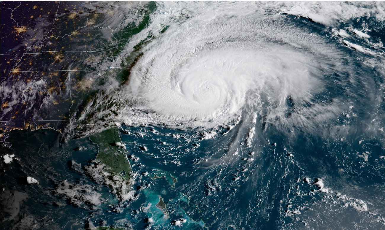
Hurricane Florence, a Category 2 on the Saffir-Simpson hurricane scale, is nearing landfall along the East Coast. The storm is expected to do so in the early morning near Wilmington, N.C., before moving south along the coast, and inland through South Carolina. Millions of residents of both states have evacuated inland. Florence is expected to bring a storm surge of up to 13 feet in some areas, and is forecast to produce 20-30 inches of rain in some areas. Higher amounts, in very localized areas, of up to 40 inches are possible.
Latest Update: Sept. 13, 8:30am ET:
Hurricane Florence is now a Category 2 storm, with sustained winds of about 110 mph. She is forecast to make landfall near Wilmington, N.C. on Friday in the midday, but the outer bands of the storm are already reaching far inland. The storm is then forecast to trek south westward along the coast before heading inland. Some areas along the coast may see storm surges greater than 10 feet, while areas inland could receive more than 20 inches of rain.
Latest Update: Sept. 12, 10pm ET:
Hurricane Florence remains a powerful major hurricane, but has been downgraded to a Category 3, as its sustained winds have decreased to 115 mph. The forecast track of Florence has the storm making landfall near Wilmington, N.C. around midday Friday (Sept 14), and then turning toward the west-southwest along the coast where it may make a second landfall near Myrtle Beach, S.C. The storm is then forecast to move slowly inland across the southern Appalachians into Tennessee and Kentucky.
-IO-
Latest Update: Sept. 11, 6:30pm ET:
Hurricane Florence remains a dangerous Category 4 storm, with sustained winds of 140mph, and gusts far exceeding that. The states of North Carolina and South Carolina have declared emergencies and are evacuating residents from coastal towns and flood-prone areas. The hurricane is projected to make landfall on Friday afternoon near Wilmington, NC. Visit the National Hurricane Center for more information.
Update: Sept. 11, 8:55am ET: Hurricane Florence is forecast to strike near Wilmington, North Carolina, on Friday morning (Sept. 14). The latest reports from the National Hurricane Center note the Category 4 storm now has sustained winds of at least 140 mph. The Outer Banks of North Carolina are beginning mandatory evacuation.
Update: Sept. 10, 12:30 pm ET: The National Hurricane Center has upgraded Hurricane Florence to a Category 4 storm, with maximum sustained winds near 130 mph. The storm is still on a track that would have it making landfall as a major hurricane on Thursday near the southern North Carolina coast. The storm is then forecast to stall over the Carolinas and Virginia, bringing significant rainfall in excess of 20 inches in some areas.
North and South Carolina’s state governments have begun issuing warnings and are preparing evacuation and emergency actions.
——
Disaster Supply Checklist (from Ready.gov)
——
From the coast of Georgia to North Carolina, the U.S. East Coast is bracing as Hurricane Florence strengthens in the Atlantic Ocean.
Florence, which formed off the coast of Africa on September 1 and has meandered since, is now zeroing in on the coastal border between North and South Carolina. It is expected to make landfall on Thursday (Sept. 13) as a major, category 4 hurricane, according to the National Hurricane Center. A category 4 hurricane is defined as having sustained winds of 130-156 mph.
Further out in the Atlantic, Hurricane Helene is not expected to threaten North America, but newly-named Hurricane Isaac is making a course toward the Southern Caribbean, where it is expected to strike the islands of Barbados, St. Lucia and Dominica on Thursday. Hurricane Isaac may later threaten Puerto Rico or Florida, but the forecast is too far out for certainty. Puerto Rico and the U.S. Virgin Islands were devastated in September 2017 by Hurricanes Irma and Maria.
Isaac is expected to strike the islands as either a category 1 or category 2 storm, with winds between 74-110 mph.
Another tropical disturbance is located in the Caribbean south of Cancun, and could potentially move into the Gulf of Mexico. If it develops into a tropical storm or hurricane, the next name available on the storm naming chart would be Joyce. But a succession of potential storms are also coming off the African coast, which could become named storms first.
Hawaii Threatened Again
While many in the continental U.S. will be watching the Eastern seaboard and Caribbean for the approach of Florence and Isaac, Hawaiians will be bracing for another storm.
Two weeks after Hurricane Lane prompted warnings and produced flooding on the Hawaiian islands, but ultimately veered away from a direct strike, Hurricane Olivia is taking aim. Olivia may lessen in intensity before reaching the islands, however, arriving as only a tropical storm.
—-
Useful links:
National Hurricane Center: https://www.nhc.noaa.gov
Caribbean Hurricane Network: https://stormcarib.com
Sign in to get access to this free resource, and all of our whitepapers and reports.
Download this content today!
Register Now Already registered? Click here to Log In
Tags: Taxes